
By far one of the best peaks in terms of view and elevation in the nearby and easily accessible mountains of the Western Cape. And once on the Dwarsberg Plateau, the unspoilt marshland presents one with a pleasant feeling of isolated wilderness.
Hagen Leibberger, John Crumley, Stuart Summerfield and myself met at the Jonkerhoek gate at 07h30. After obtaining permits we drove to the parking space at the bridge. Stuart, doing a reconnoiter for future MCSA outings, started on the trail past the waterfalls and up Kurktrekker, whilst the rest of us headed for the Panorama trail. Both of these end up at the Dwarsberg turn off to Victoria Peak.
In the shade from the morning sun and with a fresh wind blowing, the ascent up the Panorama trail went smoothly. This trail is longer than the Kurktrekker route, but much better maintained and the gradient is mild.
We passed several good streams and higher up had a good view of a rainbow forming in the spray above the waterfalls on the opposite side of the valley, as well as the Kurktrekker. A little detour here, on the way up we passed several granite boulders and my thoughts meandered as I plodded along. If the Jonkershoek mountains had a spirit, an essence, what would it be like? The answer was obvious, a fire element from the intrusive igneous granite magma tempered with the water sediment of the overlain quartzitic sandstone. The thought bemused me no end. On a more rational plane, here is a brief description of the geology taken from The Vegetation of the Swartboschkloof by David Jury McDonald 1983. Porphyritic Cape Granites underlie the Table Mountain Group of quartzitic sandstones (T.M.S.) fanning the precipitous mountains at Jonkershoek (Taljaard, 1949) and the granite forms the undulating floor of the Swartboschkloof valley. The sandstone cliffs do not erode readily. Nevertheless, the debris from these cliffs together with granite boulders form a colluvial admixture covering the granite floor of the valley.
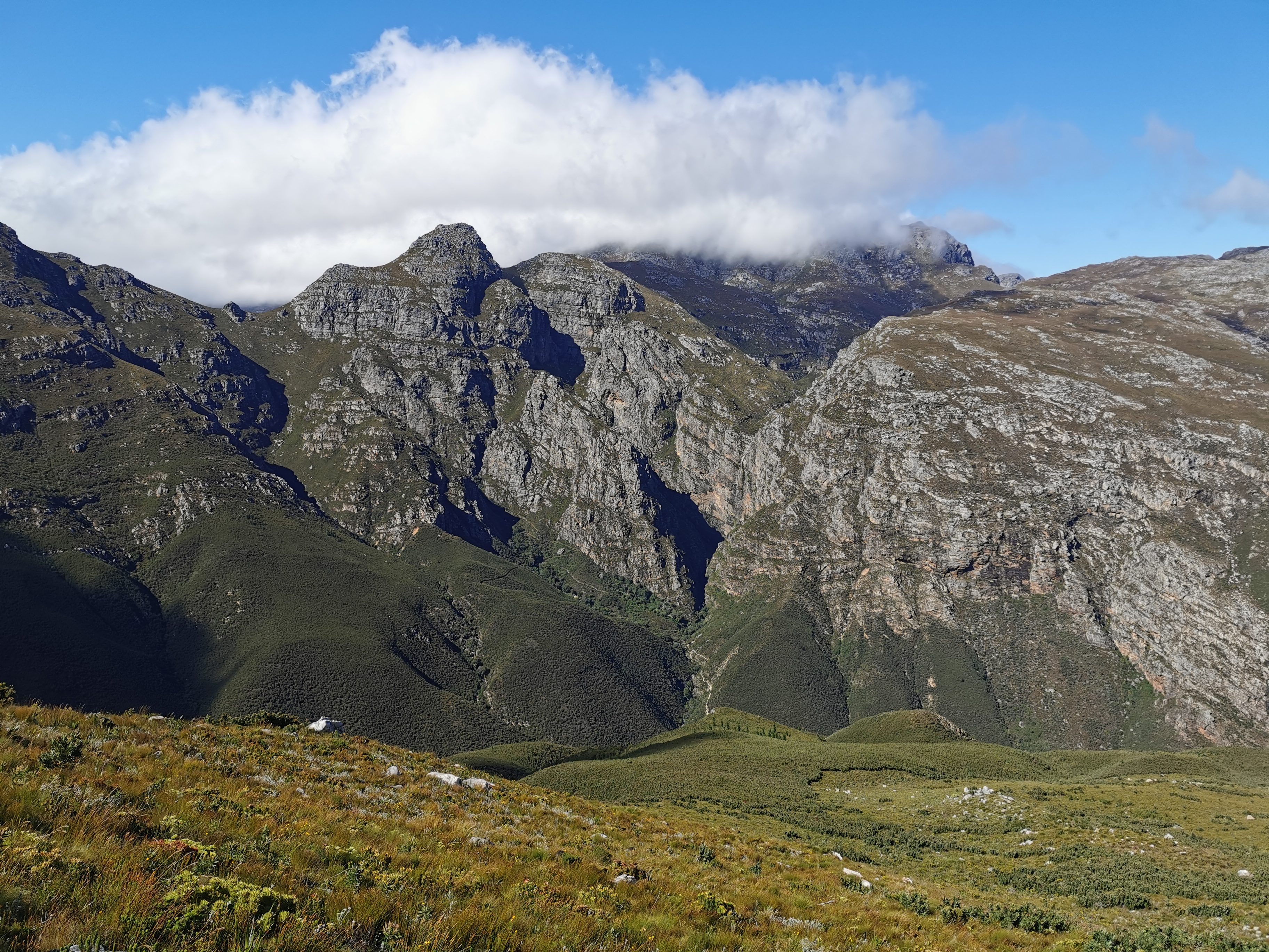
At this stage of the morning ~10h30, there was still mist clouds on the surrounding higher peaks. Eventually we reached Bergrivier Neck which gave us a glimpse down the Bergriver valley towards Fransschoek.
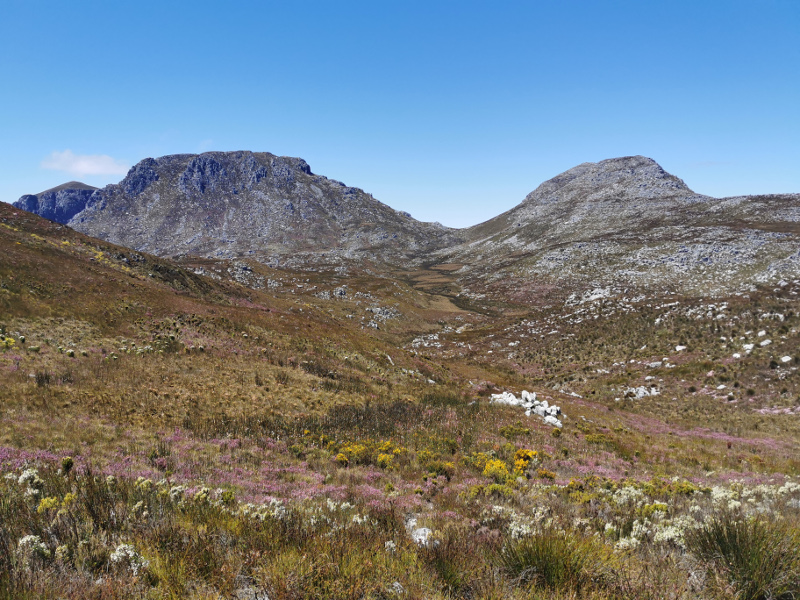
From there onwards the gradient increased as we moved into the mountains proper. Spectacular views kept one entertained and the path eventually eased off to near level. The air was still cool and pleasant with lots a streams crossing the path.
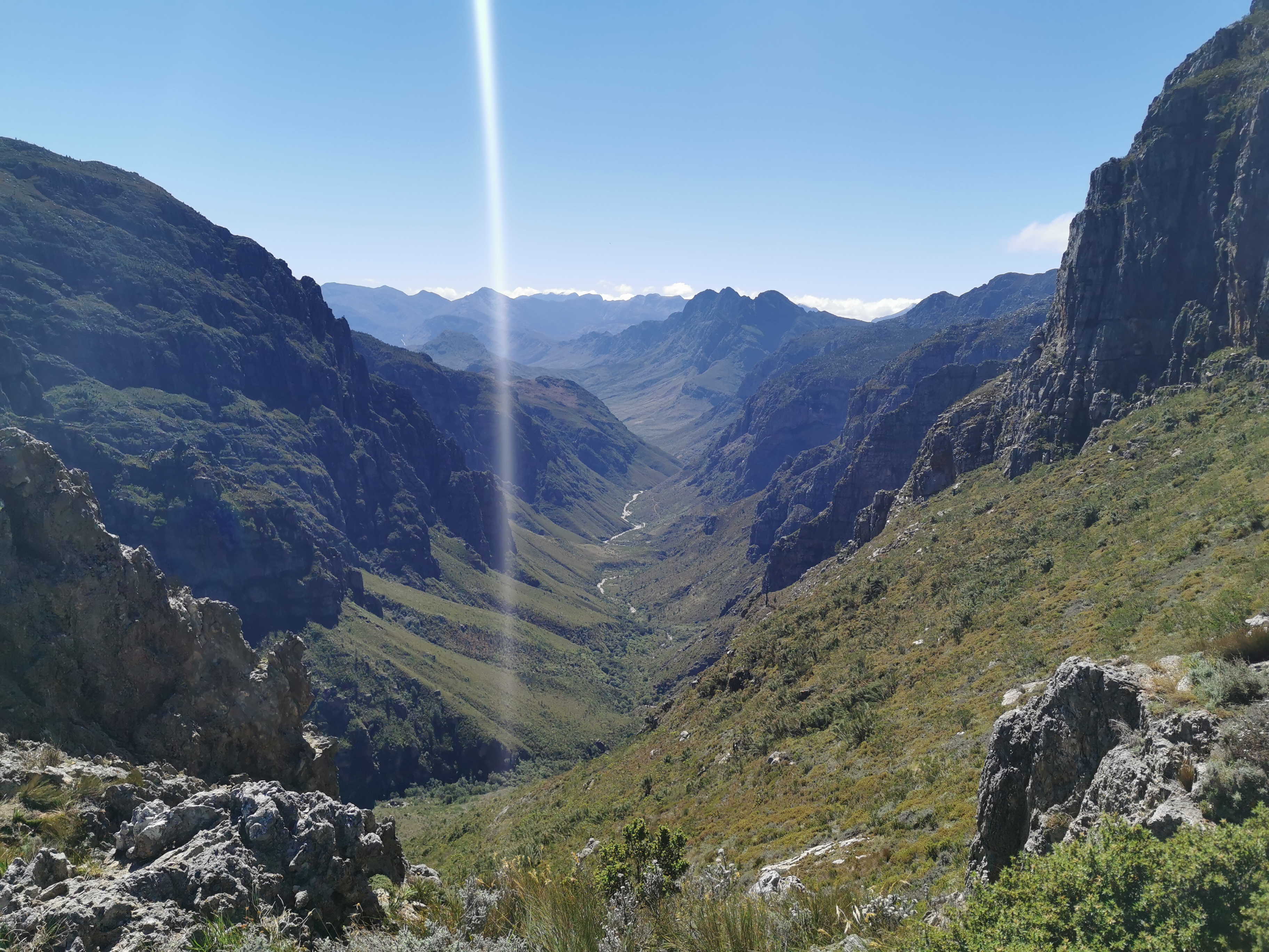
We turned off at the Dwarsberg plateau intersection, marked with a cairn on either side of the trail, heading South-East. Coming out of the wet winter season here in the Cape, the track was waterlogged in some places but not impassable. As always, these level areas in the high Cape mountains fills me with a joyous(welcome?) sense of true disconnection from the modern world. Perhaps the isolation – the cities and roads are hidden from view, or the ease of walking after the climb brings on this feeling. Or perhaps it is the lone standing sandstone “menhirs” keeping watch over the landscape. The wonderment is always there.
Finally we reached the steep ascent to the Victoria peak summit. We slowly made our way up, engaging in conversations regarding the mystery of gravity. Always a common topic when you are working hard against it. 😉 By this time all mist had cleared so we anticipated some legendary views. A minor attack of summit fever set in. Near the top Stuart unexpectedly popped over the horizon, looking fresh and relaxed. He had been there quite a while and was making his way down. We compared notes and carried on up, whilst he undertook to take the Panorama route down.
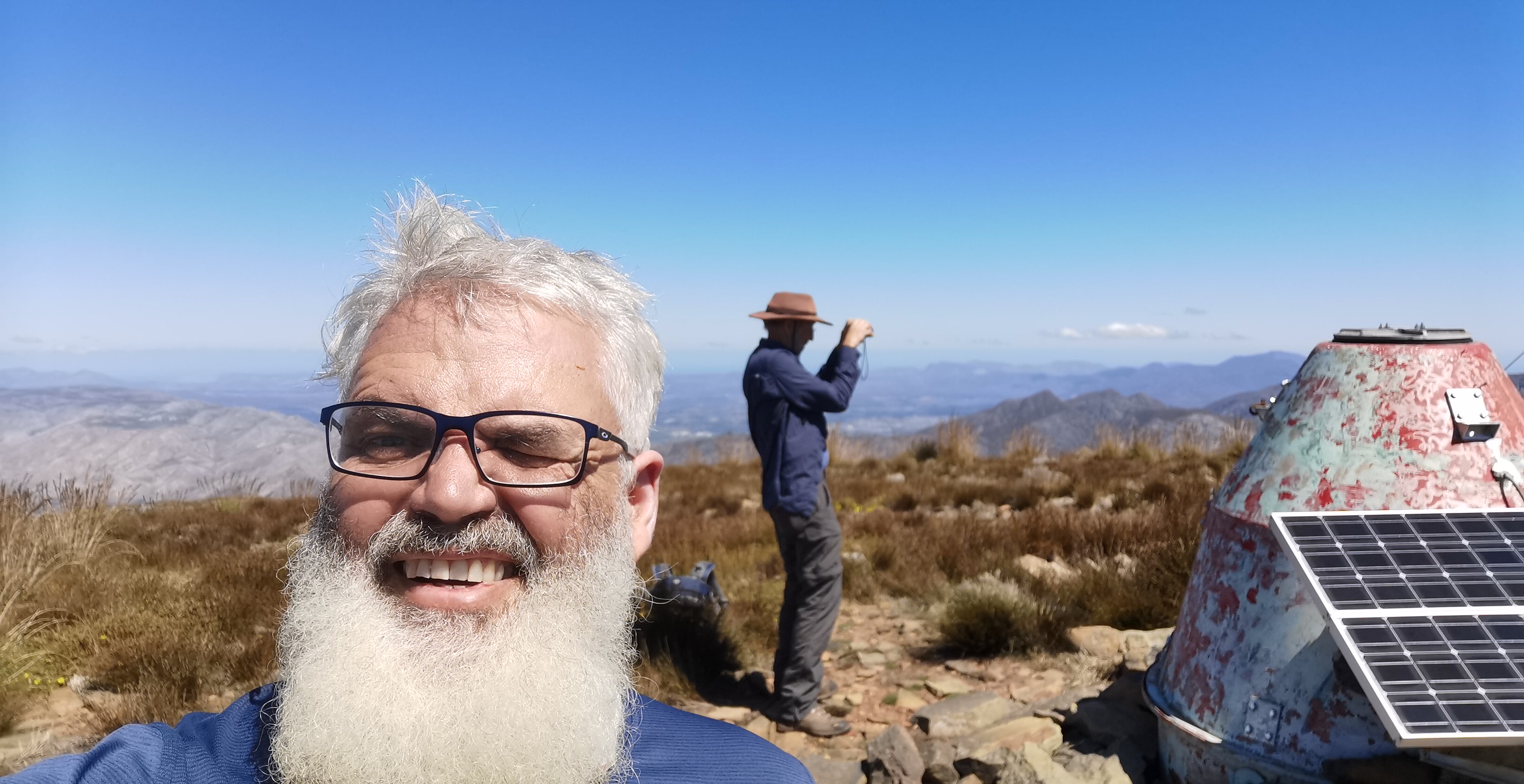
And finally we were there. Grabouw, Caledon, Fisherhaven Theewaterskloofdam where all visible. Those high mountains you see behind the Theewaterskloofdam when driving from Grabouw to Villiersdorp, yep, we were on them.We even found “sputnik” on the summit.
We ate some snacks, drank some black, bitter coffee – thanks John – and headed back. The back journey is always done in mostly autopilot. We decided to take the Kurktrekker down. Time was running out as we had to make the gate with our vehicles by 18h00. Now I have heard some stories regarding the infamous Kurktrekker. As usual I dismissed them as “mountaineer’s exaggeration”. Come on, how bad can it be. In the heat of the afternoon sun baking into the that corner valley, and an erosion gully for a path, it ain’t a picnic after a day’s hike, at least for an oldish, portly madman like myself. Some serious path maintenance need to be done by the powers that be, perhaps even a new layout for the upper reaches that zigzag more, to preserve the path. Arriving at the vehicles was a good moment, as the whole day was. I would do it again.
Some beta from my backcountry navigator app: Total Time: 10:59, Altitude Gain: 1308, Total Distance: 18.74
The track is marked on https://opentopomap.org/#map=15/-34.00208/19.00922 and OpenCycle maps.